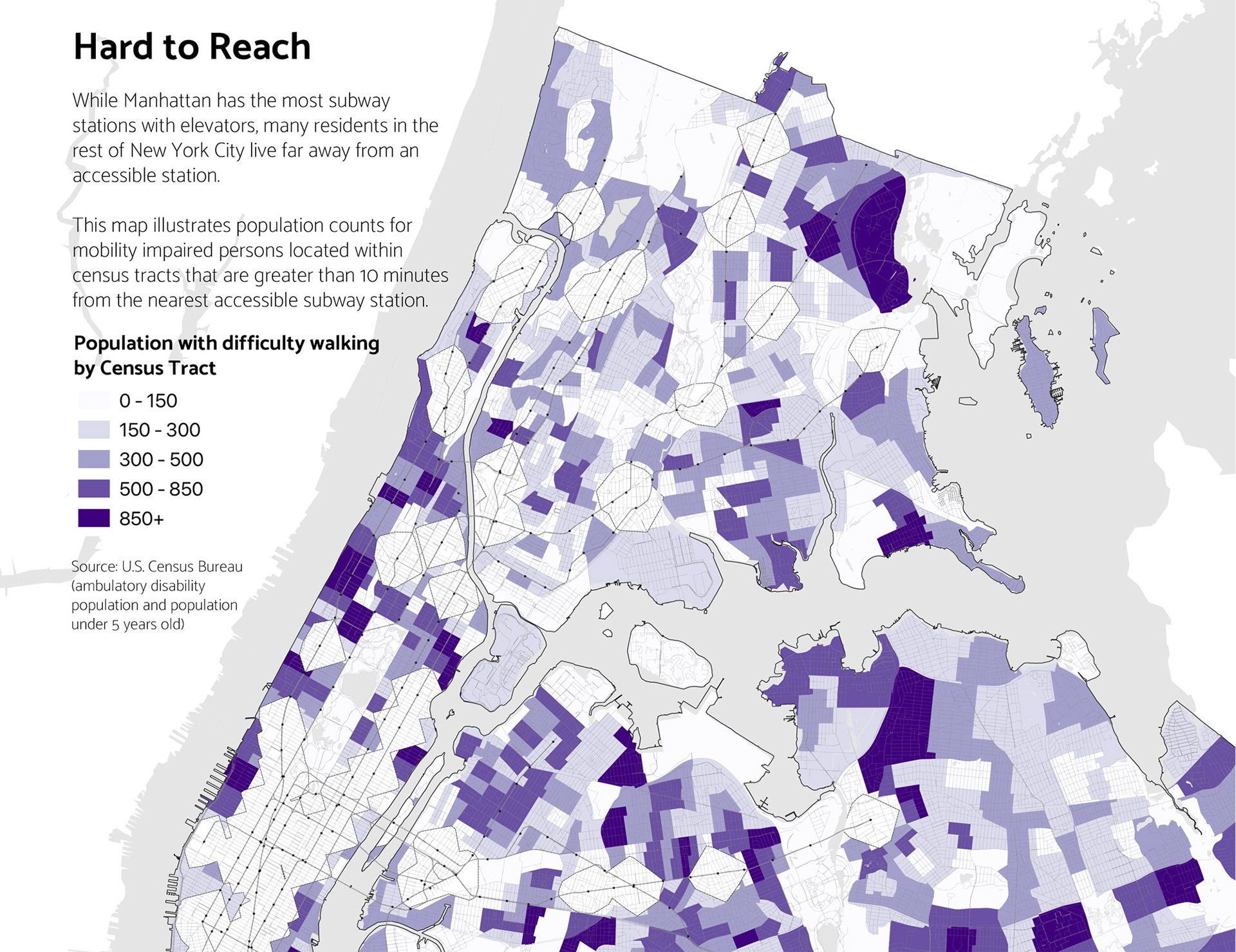
This is a more detailed recreation of spatial analysis and mapping done by Jugal Patel of the New York Times: https://www.nytimes.com/interactive/2019/02/11/nyregion/nyc-subway-access.html?smid=pl-share
Tools used: QGIS
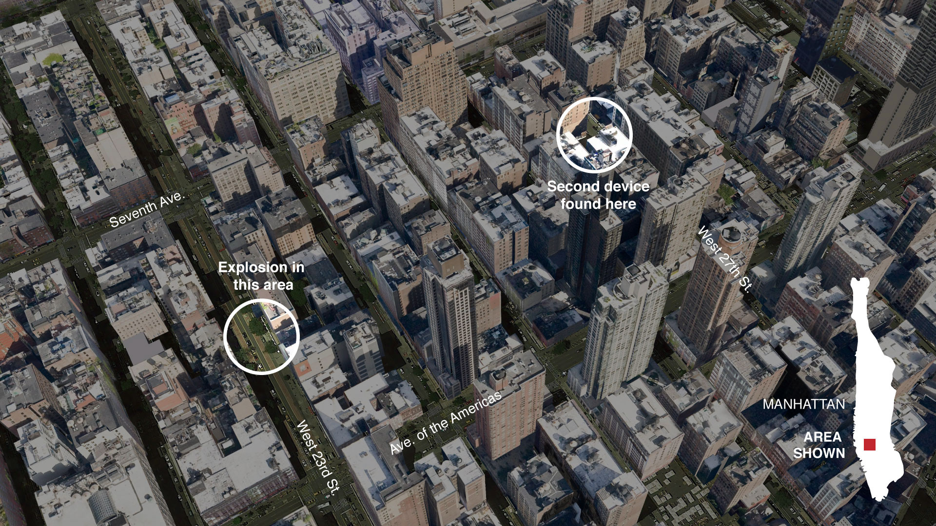
Re-creation of a New York Times locator map.
Tools used: Google Earth, Adobe Illustrator

Mock-up/original graphic for this story: https://www.insider.com/jeffrey-epsteins-jet-spotted-in-middle-east-2019-8
Tools used: Python (analysis), QGIS, Adobe Illustrator